GPS PHOTO VERIFICATION

Turn field photos into location-backed evidence.

FieldProof helps field teams capture GPS-tagged photos, videos and timestamps while documenting work, inspections, site visits and project activity. Create a clearer photographic evidence trail from the actual field location—even when connectivity is limited.

GPS tagged Timestamped Photo & video Offline ready

FieldProof GPS-tagged photo capture screen
GPS PHOTO EVIDENCE

Capture photographic evidence with location and time context.

A field photograph can show what happened, but knowing where and when it was captured can make the evidence much more useful for field verification and review.

FieldProof connects field photographs and videos with relevant location and timestamp context, helping teams create organised evidence from site visits, inspections, installations, maintenance and other field activities.

WHAT IS GPS PHOTO VERIFICATION?

Add location context to field photography.

GPS photo verification refers to using location-aware photographic evidence to help establish the context of a field activity.

Instead of treating a field photograph as an isolated image, FieldProof helps associate captured evidence with the relevant field activity, location and time.

This is particularly useful when teams operate across multiple sites and managers need to review evidence remotely.

FieldProof GPS photo capture for location-backed field evidence

Capture from the actual field location

Create photographic evidence with useful location and time context.

GPS PHOTO CAPABILITIES

More context behind every field capture.

Capture visual evidence together with the field information needed to understand it later.

GPS-Tagged Photos

Capture photographs with location context from the field where the evidence is created.

Timestamped Evidence

Maintain time context around photographs and other field evidence.

Field Photography

Document site conditions, completed work, assets, installations and field activities.

GPS Video Evidence

Use video when a moving visual record provides more useful context than a single photograph.

Project-Based Evidence

Associate field photographs with relevant projects, sites and activities.

Offline Capture

Continue collecting photographic evidence when internet connectivity is unavailable or unreliable.

GPS PHOTO VERIFICATION WORKFLOW

From field photograph to organised evidence.

Keep the evidence connected to the activity and location where it was captured.

1

Reach the Site

The field worker visits the relevant project, asset, site or service location.

2

Capture Photos

Photographs or videos are captured while the team is physically present at the location.

3

Add Context

Location, timestamp and project context help turn the capture into organised field evidence.

4

Review

Supervisors and office teams can review the resulting evidence and field history.

GPS PHOTO USE CASES

Use GPS-tagged photos wherever field evidence matters.

Location-backed photography can support many field workflows where organisations need a clearer record of physical activity or completed work.

Site visit documentation
Construction progress
Installation proof
Maintenance evidence
Field inspections
Contractor work evidence
Utility field activity
Solar project documentation
Telecom site evidence
Facility inspections
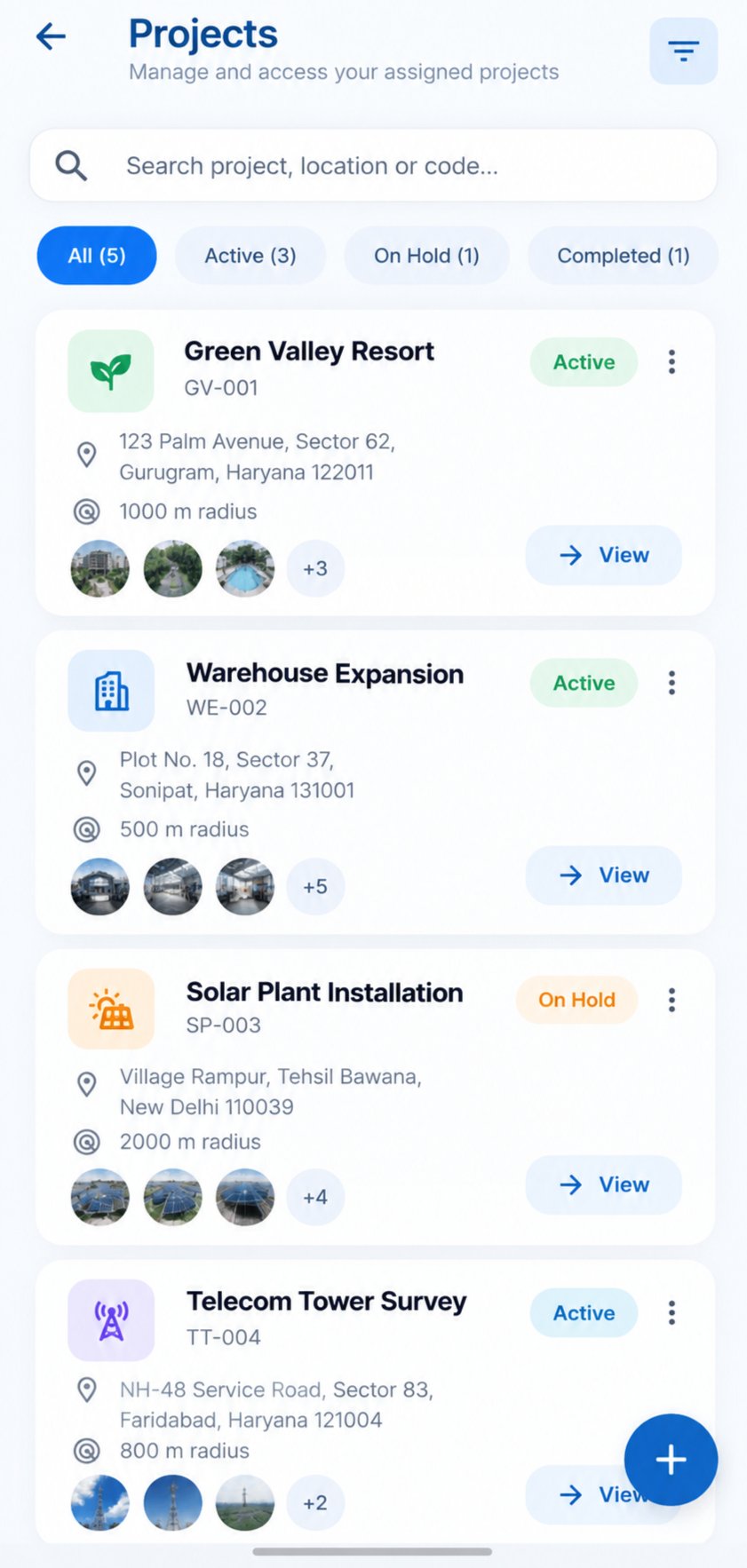
FieldProof project records containing GPS photo evidence

Keep evidence connected to projects

Organise location-backed photographs around the field projects and activities they belong to.

FieldProof dashboard for reviewing GPS photo evidence
WHY LOCATION-BACKED PHOTOS?

Give managers more context than a standalone photograph.

Field teams may capture hundreds or thousands of photographs across different projects and locations. Without context, reviewing those images later can become difficult.

Location and time information can provide additional context around field evidence, helping reviewers understand where and when the photograph was captured.

Location Context

Understand the field location associated with captured evidence.

Time Context

Maintain useful timing information around field captures.

Project Context

Associate evidence with relevant projects, sites and activities.

OFFLINE GPS PHOTO CAPTURE

Capture field photos even when connectivity is limited.

Field photography often happens in remote areas, infrastructure locations, construction sites, rural projects and other environments where a reliable internet connection cannot always be expected.

FieldProof is designed to support field evidence collection in these environments. Teams can continue capturing evidence and synchronise it when connectivity becomes available.

Work Offline

Continue collecting field evidence when network access is unavailable.

Synchronise Later

Synchronise retained evidence when a suitable connection becomes available.

FieldProof mobile app for field evidence capture
BENEFITS

Build a more useful field photo record.

FieldProof combines visual evidence with the context needed to review field activity.

Location-Aware

Add useful location context to photographic field evidence.

Time-Aware

Maintain timestamp context around field captures.

Organised

Connect field photographs with projects and activities.

Easier to Review

Give supervisors and managers more context when reviewing field evidence.

INDUSTRIES

GPS photo evidence across field-intensive industries.

Use location-backed photographs wherever physical work needs to be documented.

RELATED SOLUTIONS

Explore related FieldProof solutions.

FREQUENTLY ASKED QUESTIONS

GPS photo verification FAQs.

GPS photo verification uses location-aware photographic evidence to provide additional context around field activity. FieldProof combines visual evidence with location and timestamp context to help teams document field work.

GPS-tagged photos are photographs associated with geographic location information. They can provide useful location context when documenting field activity, inspections, site visits and completed work.

Yes. FieldProof is designed to capture location-backed photographs and videos from field locations together with relevant timestamp and project context.

FieldProof is designed for field environments where connectivity can be limited. Teams can continue capturing field evidence and synchronise it when connectivity becomes available.

GPS photo evidence can be useful for site visits, inspections, construction progress, installation documentation, maintenance activities, contractor work, utility field activity, solar projects and other field operations.

No. GPS-tagged photography is one part of FieldProof. The broader platform is designed for field verification, evidence collection, project records, field history and review of field activity.
READY TO VERIFY YOUR FIELD WORK?

Turn field activity into trusted evidence.

See how FieldProof can fit your sites, teams and reporting workflow.